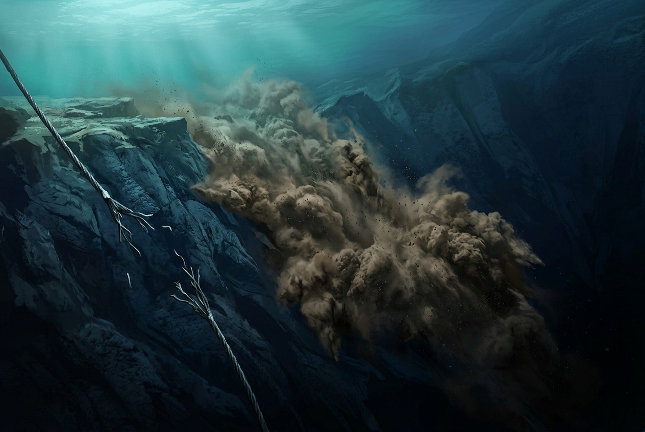
Beneath the ocean’s surface, far from human eyes, some of the most powerful geological events on Earth unfold in near-total darkness. Imagine an avalanche—not of snow, but of sediment-laden water—thundering down a continental slope at speeds rivaling cars on a highway. These are turbidity currents, and they rank among the most dramatic yet least witnessed phenomena in physical geography. They carve canyons deeper than the Grand Canyon, transport more sediment than all the world’s rivers combined, and occasionally remind humanity of their power by severing the undersea cables that carry our internet traffic.
What Exactly Is a Turbidity Current?
A turbidity current is a fast-moving underwater flow of water mixed with suspended sediment—sand, silt, and mud. Because this sediment-water mixture is denser than the surrounding seawater, it behaves like a distinct fluid, hugging the seafloor and racing downslope under the pull of gravity. Think of it as the marine equivalent of a snow avalanche or a pyroclastic flow from a volcano.
These currents can be triggered by several events:
- Earthquakes that destabilize sediment piled on continental slopes
- River floods that dump enormous sediment loads directly into the sea
- Storms and hurricanes that stir up shallow seafloor deposits
- Simple oversteepening, when sediment accumulates until the slope fails under its own weight
Once moving, a turbidity current is self-sustaining in a remarkable way. As it flows, it erodes the seafloor beneath it, picking up more sediment, becoming denser, and accelerating—a feedback loop scientists call “ignition.” A modest slump can thus grow into a flow hundreds of meters thick, traveling hundreds of kilometers across the ocean floor.
The 1929 Grand Banks Event: A Detective Story Written in Broken Cables
Our understanding of turbidity currents owes an enormous debt to a disaster off the coast of Newfoundland, Canada. On November 18, 1929, a magnitude 7.2 earthquake struck beneath the Grand Banks, a shallow fishing region in the North Atlantic. The quake generated a tsunami that killed 28 people along Newfoundland’s Burin Peninsula—one of Canada’s deadliest natural disasters.
But the earthquake also left behind a puzzle. In the hours following the tremor, twelve transatlantic telegraph cables snapped—not all at once, but in a precise sequence, one after another, progressing downslope and away from the epicenter over the course of 13 hours. Cables nearest the earthquake broke immediately, presumably from the shaking itself. But cables located hundreds of kilometers away broke hours later. What could travel that far, that fast, along the seafloor?
In 1952, geologists Bruce Heezen and Maurice Ewing published a landmark analysis. By using the telegraph companies’ records of exactly when each cable failed, they reconstructed the passage of a colossal turbidity current. The earthquake had triggered a massive submarine landslide, which evolved into a sediment flow that raced down the continental slope at speeds estimated up to 100 kilometers per hour (about 60 mph)—faster than the speed limit on most highways. The flow traveled more than 700 kilometers into the deep Atlantic, depositing a sediment layer up to a meter thick across an area larger than many European countries.
The broken cables, an economic nuisance for telegraph operators, became an accidental scientific instrument—the first “measurement” of a turbidity current in action.
Sculptors of the Seafloor: Submarine Canyons
One of the great puzzles of early oceanography was the existence of enormous canyons slicing through continental margins around the world. Monterey Canyon, off the coast of California, is comparable in scale to the Grand Canyon—plunging to depths of over 3,500 meters. Similar features exist off the Congo River in Africa, the Ganges-Brahmaputra delta in the Bay of Bengal, and the Hudson River off New York.
How were these canyons carved? Rivers couldn’t have done it—sea level has never dropped far enough to expose these depths. The answer, we now know, is turbidity currents. Flow after flow, over hundreds of thousands of years, these underwater avalanches erode the seafloor like liquid sandpaper, deepening and extending canyons far out onto the abyssal plain.
At the mouths of these canyons, the currents slow and drop their sediment loads, building vast submarine fans. The Bengal Fan, fed by sediment from the Himalayas via the Ganges and Brahmaputra rivers, is the largest sedimentary feature on Earth—stretching roughly 3,000 kilometers across the floor of the Bay of Bengal. In a very real sense, the Himalayas are being slowly transported, grain by grain, into the deep Indian Ocean.
Catching an Avalanche in the Act
For decades after the Grand Banks analysis, turbidity currents remained frustratingly elusive. They occur unpredictably, in deep water, and tend to destroy any instruments placed in their path. Scientists studied their deposits—distinctive graded layers called turbidites—but had never directly observed a large flow.
That changed in the 21st century. Beginning in 2015, the Coordinated Canyon Experiment in Monterey Canyon deployed a network of rugged sensors, moorings, and even instrumented boulders designed to be swept along by flows. The results were stunning. Researchers recorded multiple turbidity currents, some traveling over 8 meters per second, and discovered that the flows behaved differently than models predicted: the leading edge often moved as a dense, fast layer of remobilized seafloor sediment—almost like the canyon floor itself getting up and moving.
Meanwhile, off West Africa, monitoring in the Congo Canyon captured something even more extraordinary. In January 2020, following major flooding on the Congo River, a turbidity current traveled more than 1,100 kilometers along the seafloor over two days—breaking two submarine cables and disrupting internet service across parts of West Africa, from Nigeria to South Africa. Nearly a century after Grand Banks, turbidity currents were still snapping cables; the difference was that this time, scientists had instruments waiting.
Why Turbidity Currents Matter Today
These flows are far more than a geological curiosity:
- Global communications: Over 95% of intercontinental data travels through submarine cables. Understanding where and when turbidity currents strike helps engineers route cables more safely.
- Carbon cycling: Turbidity currents bury vast amounts of organic carbon in deep-sea sediments, playing an underappreciated role in Earth’s climate system.
- Oil and gas: Ancient turbidite deposits form some of the world’s most important hydrocarbon reservoirs, from the Gulf of Mexico to offshore Brazil.
- Hazard assessment: Turbidite layers in seafloor cores serve as a “paleoseismic record”, helping scientists estimate earthquake recurrence along fault zones like the Cascadia Subduction Zone off the Pacific Northwest.
The Hidden Rivers of the Deep
Turbidity currents remind us that the deep ocean is not a still, static place but a dynamic landscape shaped by episodic violence. They are Earth’s great conveyor belts of sediment, connecting the summits of mountain ranges to the deepest abyssal plains. From a mysterious sequence of snapped telegraph cables in 1929 to instrumented canyons streaming data today, the story of turbidity currents is also a story of scientific ingenuity—of learning to see events that no human eye will ever directly witness. Somewhere right now, on a dark continental slope, sediment is piling up, waiting for the trigger that will send it thundering into the deep.